Wrong Sturgis (2023-09-26)
When the canal gate control operator arrived in the morning he told us they stopped allowing overnight stays, after having problems with vagrants fighting in 2022. Turns the firehouse side of the river is all considered "town park", so we should not have camped on that side at all. The other side of the river is a trail and not consided to be the park owned by the town. Tenting on that side, with a similar flat mowed grass lawn is fine. You would just need to cross over the lock footbridge to use the park portapotties. And to carry over camping gear from your vehicle!
After packing up the very moisture ladened tent, I was on my way without coffee. Turns out this was the same section of Rt90 I rode eastward without coffee from the failed CO trip last month. The first plaza this morning only offered gas and no coffee. Making me wait for the second plaza for my Dunkin' coffee and sandwich.
That kind of put my cycle a bit off, so my fuel and food stops became staggared. Mix in one stop at a 50s diner that was closed, so I only used the restroom at the Brewery next door. The Brewery sign had a worn look and it had two storefronts. So when I parked I thought I was parking infront a Bakery. But the bathroom was nice, and my empty bladder allowed me ride on to the next plaza for water, fuel, a Burger King dinner, and another Dunkin coffee. And know I know that the Ohio BK doesn't take NH BK coupons...
I'm passing lots of potentially interesting things along this route. Mainly because my sights are set on Colorado and parks to it's west. I'm only two days from home, so I can always return here some other time. I don't know if it Rocks, but for a city Cleavland looked very inviting from the highway.
The weather check at lunch foretold of a storm in my path. I would either ride into it, or it would pass over me at the campground. It all depended on how far west I made it before camping. The radar showed a long arched band rotating like a curved sword blade. Relatively thin, but with a yellow core, and dots of red. I picked a campground a few hours ride ahead and kept one eye on the sky. When still about an hour out I felt the darkening sky was closer than an hour. A check of the GPS weather map showed the yellow band was over my campground. That sounded great because I could suit up, ride through and setup the tent post rain. And that is close to what happend.
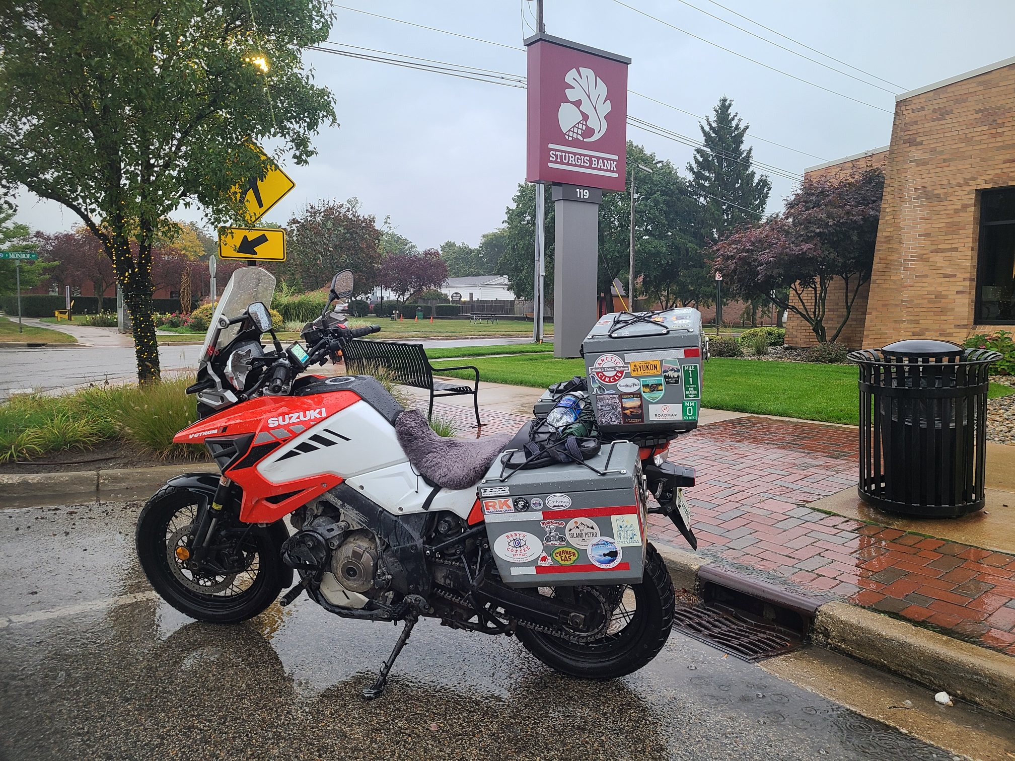
First I needed to suit up and I was coming upon Sturgis. Just a Sturgis in MI, not SD. That sounded like a funny stop, and it was only 25 minutes closer to the black sky. Long story short I didn't make it to Sturgis before the rain. I ducked into a service plaza gas station just as it started coming down. I suited up there and rode 10 miles to Sturgis. Where I found very little to photograph as a backdrop to the wrong sturgis. Eventually I picked a Bank and PO, shot of downtown. Another interesting fact is that Main Street in Sturgis MI is 66. I don't know if it's that 66, still have to check, but I expect to ride some of the old Rt66 later during this trip.
After the wrong Sturgis, in the wrong state and weather, i got back onto Rt80 West. Where I rode out of the darkness and into the light. That sounds great, but really it means riding in rain with a fogged up helmet while trucks spray you with water. Then the rain stops but fog and spray continue for awhile. Eventually the late day sun reflects off the wet mirror of a road and you can hardly notice that your visor is no longer foggy.
Eventually I reached Elkhart Indiana, yes that same Indiana of my nighmares. But I figured I would give IN a second chance to redeem itself. It can't all be bad. My escape route (Plan B) was north over the boarder back to the safety of Michigan. Elkhart IN seems normal. I'll end on that unexpected bombshell and spare you the soggy saga of the tent I packed up wet this morning.