Smoke, bear, road closed (6/2/23 Fri)
On day one I converted to metric. So I've covered 841 km before this morning. I have payed for lots of things with local cash, so I don't incure so many conversion fees. So I've lost track off my gas and fillups. Consumption is between 16-19km/l. And a litre of premium seems to run about 190. Canada lists prices ins pennys per letre, so I do too.
I was awake early, but had to pay for my tent site, so I went back to sleep. I was at the door at 0800, but they opened at 0700. I should have taken a picture of the hours the night before. As added to yesterdays blog entry I just got up and packed up, getting my first coffee at refuel #1 about 90 minutes into the day.
So later in the day the highway was stopped by CMP. The officer didn't speak much english, but we determined I was good to go. I think there was a fire burning in an area call Forestel, PQ. Sounds like they didn't stop people but wanted them to know it was not under control and not even completely located. Just lots of smoke. The officer was content that I wasn't entering the backwoods, just rolling through on route to the Yukon. There seem to be dark fog, and a smoke odor like campfires further along the road. But luckilly that is all I experienced.
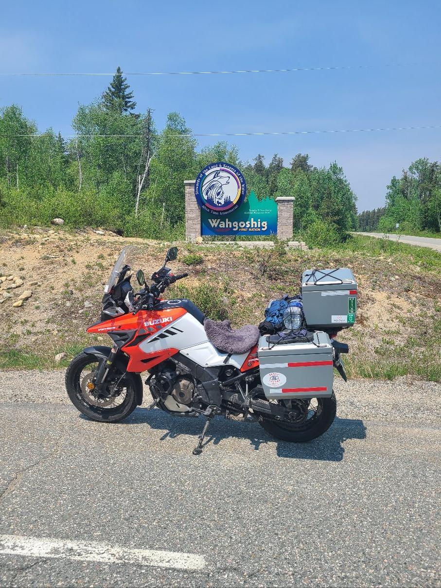
The area I passed through has a lot of small lakes and ponds. Endless conifer and birch forests of relatively small size trees. Very pretty, but I don't think I captured photos of the nicests places. The roads curved sometimes but often had long straight sections with small rolling hills. I snapped a photo of the bike next to a first nation sign that was very nice. It's a very beautiful area with a lot of bugs. They show up quickly when you stop to take a photo.
Some of the long stretches later in the day offered up mirages. I played god (or at least Moses) and just rode into the parting sea.
At some point I ganced up and notied a bear leaving the pavement and dropping into the right hand ditch along the road. He wasn't all that far in front of me but went invisible into the brush. Leaving me with just a flash to identify and work out that was the only thing it could be. A black bear of medium to small stature.
One really nice feature that has help put my mind at rest is the Garmin Zumo XT can be reset at refuel, and set with your bikes range and how many miles remaining when you refill. Given my variation in mileage I cheated on both range and put in a healthy buffer. So I set 333km per tank and 80km worth of fuel. That's all fine but then I turn on dynamic fuel stops. That's the magic. As long as I reset the gps at fuel stops, and always use the gps, then it then knows how much fuel remains. When my destination exceeds the range-buffer it asks if I want to find gas. If I say yes is searches the route and lists the farthest stations first. Since I need Premium fuel, I select the furthest location with multiple options. An easy fallback for the station having no Premium or even being a vacant building. The best part is that if it can't find one, I can buy a fuel can at the station I'm sitting at. Since I must have just filled my tank annd reset the gps.
Sounds like a brilliant and foolproof plan. Until the real world gets to it. So there I was blissfully rolling along, fighting with google assistant about audible, when the open highway was different. There was that smoke I expected to find and cars in my lane with brake lights and stopped. This was from a distance. As I got closser I could see police lights in the smoke ahead and the traffic was stopped. At least most of the traffic. Some vehicles went around on the shoulders kicking up clouds of dust. After a few minutes of sitting with my flashers on I turned off the bike. We moved a bit, but the cars passed by in the dirt a few at a time each way, enough to account for or minor movements. At some point a car coming from the dirt cloud we headed for felt bad for me and stopped to provide info. I'm sure he was a biker. He said I should take the dirt shoulder and a side road into town to avoid the road that was shutdown due to an accident. At least thats sort of what I understood. He said there are hundreds of cars going around that way and this line is really long. I could find nothing on my gps that looked like it would get around, but the pickup in front of me then jumped into the shoulder and I followed. We traveled along the dirt shoulder for many kilometers in a cloud of dust. Eventually he cut through the parked line and went against the non-oncoming traffic. I contined on the shoulder, assuming the upcoming bridge was a pinch point for him. Eventually I made it far enough to a road on the gps that wasn't a dead end. It was dirt and the line of cars continued into the cloud of dust. In case it isn't obvious to the reader, there was no smoke, only dust.
Once into the main town there was very little traffic and it was operating normally. So I headed through only to find the Rt11 bridge out of town had a road closed by CMP sign. The gps showed no alternate route. While turning around I noticd a woman in a truck and asked how to get around. She said there is no way. When I told her I didn't care if I was much further North or South because I'm traveling a long way West things changed slightliy. She said if I could do backcountry dirt and rode at night I could go south about 5 hours to the lower road. Or backtrack the way I came 3 hours and take a paved road south. The road had been closed for the last 9 hours and they didn't have word on when it might open. With those as my options camping in town seemed the best option. Then she told me the campground in town on the gps was gone. I could go back 20 minutes to camping.
Defeated I started backtracking, but realized I should eat first. After eating I realized all this was not going to make my fuel planning work out, so I refueled. I was at the pump when a CMP officer returned to his car. Will it be open by morning I asked? It will be open in about 30 minutes, he replied. Great. So I went to Walmart, which took 30 minutes to not find a digital camera. Upon returning to the bridge I was behind a truck that went onto the bridge, and I followed only to see the closd sign was still there. Now what do I do? A pull out on the bridge allowed me to spot to think. Since I saw no real traffic I figured I was on the fine side of the road closed sign and should go back before the fine. When back to the other end of the bridge the sign was gone, so I u-turned in the road and was out ahead of the crowd.
My lead held, but the new problem was all my prior planned stops would get me to camp after dark. And that's with sunset at 2120. The only option was one down about 130km further than I was. And thats where I stopped and type from now. A field in front of someone house they rent out to vans and RVs. I was her first 1 night tent. A real deal at $20.
It's currently 2240 and stil dusk like outside. But the moon also looks full. Nice temperatures in the tent with all the vestibules opened up. I am next to the highway, and expect more noise than ussual. But it seems far less than I saw stopped on the road.