Baxter Peak via Saddle Trail ( 6/25 Tue)
No motorcycles or dogs. The Knife Edge Trail not taken, but still fourteen hours of hiking. One mile of shit?
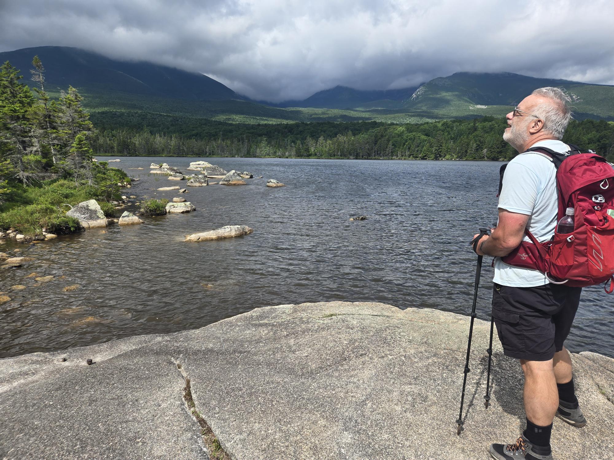
Like many campsites, slumber ended with the sounds of crows and other birds between 0400 and 0500. We had setup a tarp over our wet picnic table during our dinner the night before. A few adjustments later we had a tarp that withstood the ever changing wind swirls at our campsite. Although the forecast called for rain, our site had remained dry. Given the difficult hike, we made eggs and begels for breakfast. This took awhile to cook over the single burner stove. A cooler of iced food and a cast iron skillet are luxury items you can have when camping from a truck.
Breakfast completed, we geared up and started the hike at 0700. I packed 3L of water, as suggested by other hiker's reports. We started from Roaring Brook Campground on the east side of the range called Katahdin. FYI: Baxter Mountain is also referred to as Katahdin, but as I understand it, the peak is really Baxter. And yes, it is currenty the northern terminus for the Apalatian Trail that begins in Georgia.
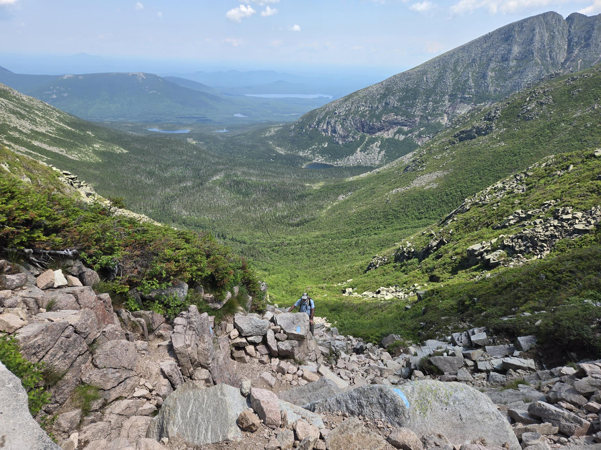
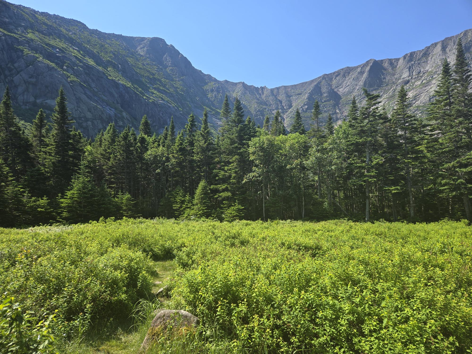
The "easy" route to summit the east side of Baxter Peak is the Saddle Trail. It begins climbing at a another campground 3+ miles from Roaring Brook. You can not drive to that campground. So, at best, it can only be an overnight stop you could choose to hike all your gear to. The route between these two campgrounds has a minimal elevation gain of just a few hundred feet. The trail is rough, with prior blast marks on large rocks, boardwalks and split log balance beams over long wet sections.
Each campground has a hiker signup board to indicate your intentions. The form has name and number of hikers, planned trails, and time in and out. The rangers check these to "account" for those not out of the woods, but they will not go looking for you until someone calls. I guess that's a good thing because our hike ended at 2130. That was 30-60 minutes after dark, even in the longest few days of the year. We completed our hike out with flashlights for the last 2 miles.
So the "real hike" starts at the second campground, with a deceiving 2.5 miles to the summit.
Sure sounds easy, and it starts out with only miner increases in the grade of the trail. Every 1/4 mile or so the grade increased. The All Trails app allows you to see the grade anywhere along the trail. I was concerned when I could move the dot to a 87 deg grade. Yes, the "easy trail" has parts that are 3 degrees less than straight up! That sounds worse than it really was. But there are parts of the rock slide that are so vertical you can not "step up", but can most often "knee up" onto the rock ledges.
Luckily we had a perfect day. Did I mention I was invited to join Mark on his planned hike. Proof that this is not always about me. The best part of that is I have someone else to blame for our slow pace. I was happy with the pace, but if you can blame someone else, I feel it's almost mandatory to do so.
Our hope was to reach the top and weather permitting hike the Knife Edge, returning to our campground to complete a large loop. In bad weather we would just turn around and retrace the "easy" path back. We had set a "bingo time" of 1400 to turn around. That time passed while we hiked the ridge to the peak. Surely it wasn't too much further? We actually turned back towards camp from the peak about 1500. Sounds like one hour late, but given we walked it both directions it amounted to finishing two hours later. So flashlight hiking was expected.
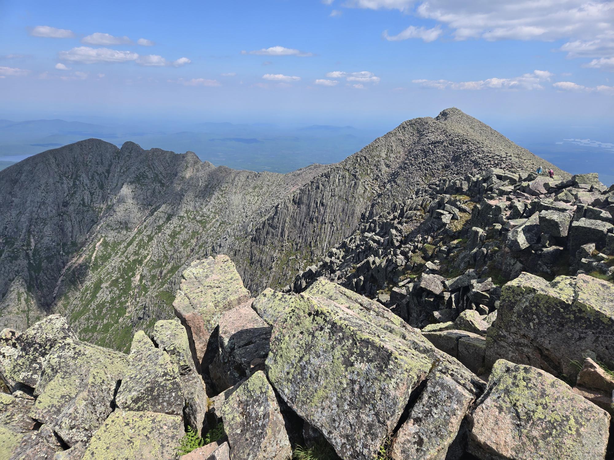
Baxter Peak and the Knife Edge are amazing. We could see in all directions, and it's incredible. The vista is too complex to describe, just look at the photos and the map. Most poeple on the top had either just finished the grueling knife edge, or really wished they had enough daylight to hike/climb it. A very interesting cast of characters. A friendly set of twins. Another pair of young women, wishing it was earlier and they had brought flashlights. OK one of them wished that, the other one couldn't believe how hard the Cathedrial Trail had been. She was a skydiver and the shear drops scared her. I was surprised to learn that she had made almost 200 jumps in about 18 months, and that many skydivers are afraid of heights. We suggested they take the easier Saddle trail down.
Nearly two hours of hiking down, we worried about not having seen these two. And assumed they haf started hiking over the knife edge very late. Then they caught up and passed us. After discovering we had the same destination, we offered them a backup plan. If it got dark just wait on the trail and eventually we would be along with flashlights. They hiked fast enough to get back without our creapy old guy illumination.
My 3L of water lasted 70% of the hike. Total hike distance was just over 11 miles, and took us 14 hours from start to finish. Arriving back at camp too late to roast the pork loin I had planned for dinner. Luckily I had forgotten my lunch sandwich for the days hike, so that became my dinner. Mark went to bed, while I made myself a pre-bedtime coffee. Being pretty sure I would sleep fine.
Lessons learned. Start as early as possible, bring flashlights. There is water along the trail if you have a water filter. Hiking Katahdin is difficult in and beautiful in good weather. I would not do it in wet or cloudy conditions.
As verbose as this entry is, I left out a few moments. During our 5 hour drive north Monday, I went into a supermarket for a lunch sandwhich, that I would fail to pack. On my way into the store, I took a small shopping cart from an older lady walking it back. Just iside the door I stubbed my tow on the casters wheels. One aisle into the store when my toes stuck to my teva sandals, I looked down to see a puddle of blood in the toe indent. Not a good pre-hike omen. A wet paper towel and a few bandages from my pack first aid kit mitigated the damaged toe.
Second event occurred just after completing the steepest section of the Saddle Trail rock slide. While resting on the top of the ridge, a couple crested and asked if anyone lost treking poles. I glanced at mine, strapped to my pack, and replied "no". Then looked at Mark's lack of poles, before changing my answer to "yes". For some reason he didn't ask me to attach his treking poles again during our hike. Smarter than he looks.
Post Baxter sumit we enjoyed one more day before our long drive home. On wednesday we hiked a short 5 mile loop. Starting it as the outhouses either side of our campsite began a stinky pump out. Earlier that morning the only road into the park was closed, because the first honey sucking truck had leaked "honey" over more than a mile of the access road. Before our thursday exit, the park had regraded the road, and some overnight rain enhanced their the cleanup efforts. So our worst sewage smell was the wednesday morning outhouse pumpout.
"no motorcycles". That's what the signs said, so I asked. It's true you're not allowed to ride a motorcyle into the Baxter Park Roaring Brook Campground. They are trying for a quiet back-to-nature feel. I acknowledged there certainly are jerks who ride motorcycles. When I also suggested a lot of jerks drive cars too, the ranger wholehartedly agreed. I then affirmed their right to dictate entrance rules, even if I don't agree with them.